


Tourniquets on public lands in the West spreading like wildfire
Private property overlaying public land is choking off access to large wildland areas throughout the West, quietly and subversively.

Posts on The Fleeting West are written and posted quickly and are often edited for clarity and quality later. For the best experience, see the copy on the website for the most up-to-date version.
It’s no surprise that tourists and transplants in the West don’t get off the beaten path, given the path is beaten entirely because this group only goes to see what they’ve already seen online, and they only go where the new trail exposure apps tell them to go. They are the beaters of the path and the cause of the path being beaten.
A little detour off the tourist and invasive tourist path, and there are little problems creeping up with our public lands in the West that very few notice.
It’s clear that not many people are interested in rambling around roads that aren’t shown on National Geographic-brand tourist maps — but when you do, you might notice how much of our public lands have little tourniquets on them. The tourniquets are fences or gates across private property that also blocks access to large swaths of otherwise public land.
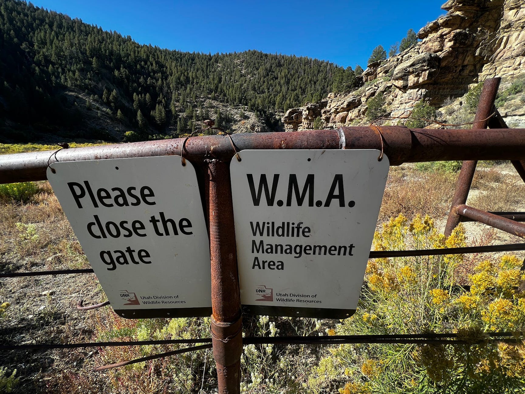
On a recent trip around an area that straddles Colorado and Utah, I found a couple great examples of where the State of Utah and the Federal land management agencies have either colluded with private interests, or have refused to enforce land boundaries with a private owner who has choked off thousands of acres with their own fence and some “No Trespassing” signs you can by at any hardware store. The private no trespassing signs were alongside State-installed signs that say the area is closed because it’s now a WMA.
Even better, I found the entire road network that was once here to be choked off the map by this “Wildlife Management Area,” planted by the state of Utah’s DNR. Very California of you, Utah…
The oddity is that the place I found this new(ish) nature area is no fewer than 100 miles to the nearest gas station. I know because I was keeping tabs on the odometer and map so I wouldn’t run out of gas. Seems like an odd spot for an urban-style parkified wildlife management area.
Even more odd was the fact that the area had a 5 foot tall fence completely keeping whatever was inside, in, and anything new out. Not very wildlife-friendly, it seems. Even better, 2.5 miles in, there was another fence like this that blocked all motion of any wildlife larger than a rabbit.
In this new wave of urban coastal land managers taking over our land management offices and strangling off parts of Western lands from the local users, it’s not uncommon to see old two track roads converted to hiking trails. Much of this blog is entirely inspired by and dedicated to bringing to light these closures.
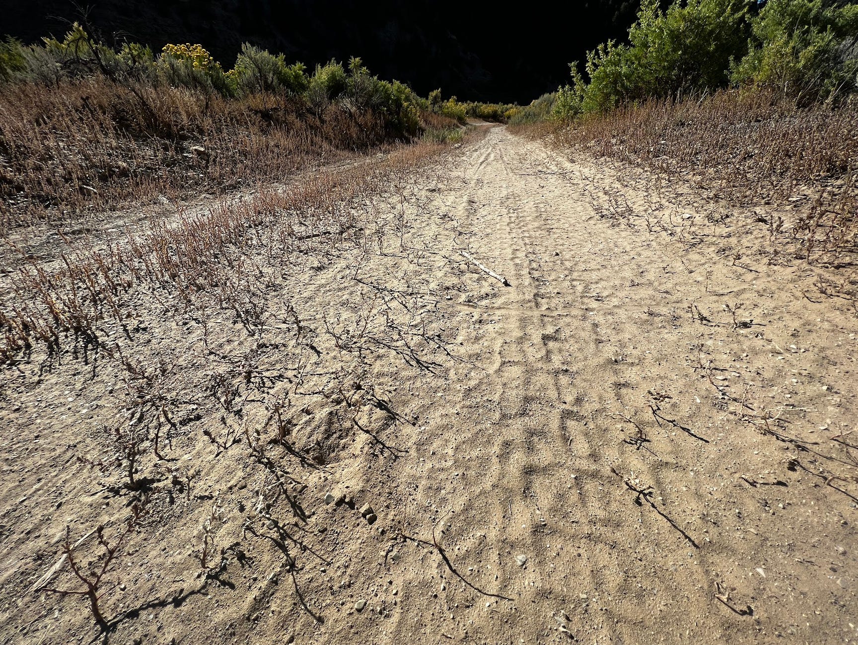
But what was odd about this one was the fact that there were tire tracks in the two track, behind a closed and locked gate. And the tire tracks kept going.
Given all the signs that say “no motor vehicles beyond this point,” I would have expected to only see Bambi’s tracks, and maybe some footprints. Nope, lots of tire tracks - fresh ones.
My little walk of curiosity hit about 2.7 miles, and poof … three trucks, seven tents, a port-o-potty, and a small backhoe. Huh…
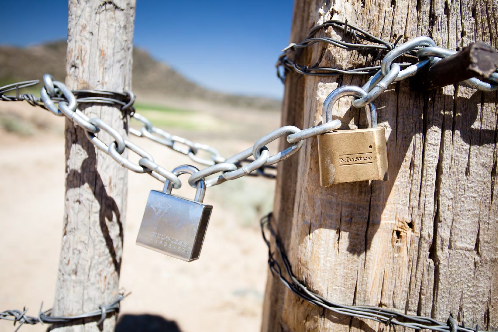
The trucks weren’t government vehicles - definitely privately owned, given age, condition, and license plates. Decade-old Dodge and a Chevy pickups with mismatched toppers. The only surprise was that it seems they could get through the locked gates, despite not being government vehicles.
Even more strange was the multiple tents. Seven tents and two pickup trucks doesn’t really add up. Three-seaters at most, I suppose there could have been multiple people packed in like tweens going to a Taylor Swift concert. It looked like a private hunting outfitter’s camp, which makes sense since it was muzzle-loading season, and there were gut piles strewn about the plateau I was on.
I’ve seen this before. Land choked off by private property. Land choked off by the federal or state governments. It’s so common right now; The choking off of land in the West is happening a thousand times faster than the opening up of new land areas … which, let’s not kid; New areas aren’t being opened at all, and won’t be.
As I walked back to the car, I started piecing it together. This wildlife management area that had cut off the old road that went down to the confluence of the canyon had special exceptions. And those exceptions weren’t available to all of us. The allowance of certain people to have a key, and certain people to drive through the area was for only special uses.
Usually, when there’s a conflict of private vs. public land or public assets in a gated area, the group with interests get together and form a lock chain where each has their own lock and key. On this gate, there was only one keyed lock, so that’s not the case here.
Given the active hunting season, and the oddity of this place being well off the typical tourist path, it seems we have a situation here where the Utah DNR has blocked off access to this area for some other reason — whether negotiated or prospective to a foreseen future condition of increased recreational use. And they either gave only their staff a key, are selling passes through the area to hunting outfits, or the area was closed off in collaboration with a private owner to claim themselves an exquisite buffer from anyone else.
After studying the scene, I suspect we have a private owner who has an easement to pass through the area, which is a pure win for them, given the extra 2.7 miles of buffer between their land access and the public.
The thing is, these little fiefdoms are popping up all over the West more rapidly than ever before. What’s glaring is the collusion between a state DNR and some private outfit who wants to run hunting parties off the backside of a wildlife management area. I mean, why wouldn’t they want that … incubate that safe zone, then shoot the freshest beasties as they come flushing out of the area. Wipe away public access and remove the roads from the map so nobody even questions it … an exceptionally effective model.
I’ve noticed an uptick in these situations, driven by the arrival of new people from all over the country looking to get themselves a piece of the Western backcountry. They find some plot somebody inherited from a long-dead relative and don’t know what to do with it, so they sell it for a pittance for dozens of acres … not many questions asked, just buy it and brag about it seems to be the method.
The growth of these little public / private collisions is bad for those of us who still use public lands and don’t just go to museumified tourist attractions. And while those of us who still use maps, time, and skills to navigate around these open spaces are few and far between, it’s also bad for anyone who may want to go roaming around the non-urban domain in the future. The option and space to do so is disappearing very rapidly.
The real oddity with this situation is that somebody at the Utah DNR thought it would be a good idea to close off a three mile stretch of two-track road that connects to a confluence of a couple backcountry canyons, and tens of miles of canyon that were once accessible. Not to mention, to only allow limited vehicular access to a lucky owner who now has a private hunting and nature preserve that is buffered by this so-called, wildlife management area. All they would have to own in this spot is one acre to create this tourniquet on this once public area.
The dividing up and sequestration of Western lands is a change that no American should find welcome. All of the tourists and invasive tourists are coming West for the imagery of Western wilderness, but it becomes more and more of a myth every day as public lands are lost to a variety of changes from outright BLM / USFS closures to private property blocking access to areas that were once accessible by otherwise unadvertised roads and trails.

Huge swaths of land in the West is up for sale by the Federal land agencies and private owners. There are owners who have never set foot in the West but happened to inherit a previously valueless land plot from long-dead relatives who claimed it in the past. It just so happens, these previously absentee landowners are now very interested in these plots of land, thanks to the fervor of interest in the West as destination country (no longer “flyover country” as American urbanites declared us until recently.)
And those buying aren’t necessarily seasoned locals who ramble around these places on the weekends - or every vacation day they get. Instead, they buy it, choke it off from access, and sometimes falsely choke off otherwise public lands with a conveniently misleading fence with some ‘No Trespassing’ signs from the hardware store. By doing so, they expand their private access significantly at the cost of the local people who have used these lands for generations.
After that, the land isn’t yours anymore — it’s a private owner’s little fiefdom where the land management agencies are complicit in the take by not strongly standing against these quietly installed access tourniquets.
The Fleeting West is written by a rooted local who still travels our lands with old skills, and is watching the permanent disolution of the West at the hands of urban land managers and private owners buying and choking off land access.